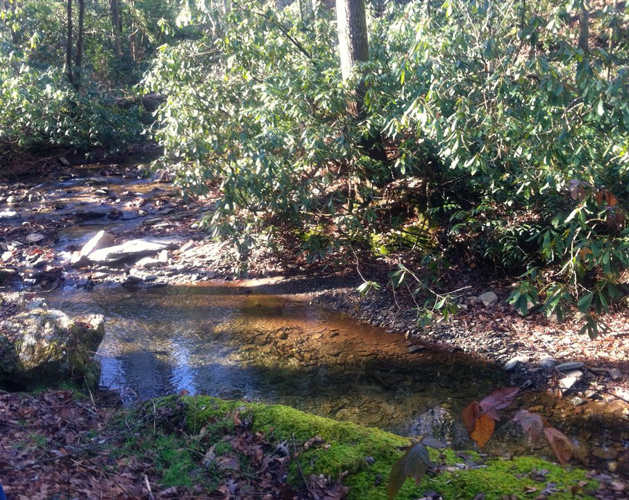
Star Gap Trail
-
Address
-
Categories
From the Old Fort Picnic Area, continue onto Mill Creek Road, passing Andrews Geyser on left to road's end, at Brookside Baptist Church. Trailhead is to right, unmarked. Approx. at .2 mile, cross RR tracks and see trailhead approximately 1.2 mile trail ascending approximately 2700 feet. Click for map and details. http://www.mtbproject.com/trail/1363959/star-gap

Find More MTB and Cycling Attractions

Corpening Memorial YMCA
Visiting members of the Y will enjoy the indoor pool, indoor basketball & handball courts, and workout room. Located off…

Greenlee Park
Greenlee Park is the perfect spot to spend the day, with accesses to Lake James for water sports, covered picnic areas, and a 1.1 mile nature trail loop!

Bad Fork
2940 Ft. /8 Miles. Primitive trail connects Woods Mountain & Armstrong Creek Trails. NC 226-A to Armstrong Fish Hatchery Rd.…

Betsy Ridge
3160 Ft./9 Mile Trail. Black Mountains view, meets Little Buck Creek Trail ending at Woods Mountain Trail. US 221 North,…

North Cove Disc Golf and Leisure Club
North Cove Disc Golf & Social Club is 157 acres of awesome rolling hills situated in a rural valley, framed…

Woods Mountain Trail
Woods Mountain Trail is not for the faint of heart! Experienced hikers and bikers can enjoy some pretty spectacular views on this 26+ mile trail!

Woodlawn Fitness Trail
Fitness Trail consists of 7 stations, two exercises per station on a 1/4 mile jogging path. Additional one mile loop…

Peavine Trail
The Peavine Rail Line, once an active Norfolk Southern Railway line, is included in the company's "rails to trails" program.…

Corpening Memorial YMCA
Visiting members of the Y will enjoy the indoor pool, indoor basketball & handball courts, and workout room. Located off…

Greenlee Park
Greenlee Park is the perfect spot to spend the day, with accesses to Lake James for water sports, covered picnic areas, and a 1.1 mile nature trail loop!

Bad Fork
2940 Ft. /8 Miles. Primitive trail connects Woods Mountain & Armstrong Creek Trails. NC 226-A to Armstrong Fish Hatchery Rd.…

Betsy Ridge
3160 Ft./9 Mile Trail. Black Mountains view, meets Little Buck Creek Trail ending at Woods Mountain Trail. US 221 North,…

North Cove Disc Golf and Leisure Club
North Cove Disc Golf & Social Club is 157 acres of awesome rolling hills situated in a rural valley, framed…

Woods Mountain Trail
Woods Mountain Trail is not for the faint of heart! Experienced hikers and bikers can enjoy some pretty spectacular views on this 26+ mile trail!

Woodlawn Fitness Trail
Fitness Trail consists of 7 stations, two exercises per station on a 1/4 mile jogging path. Additional one mile loop…

Peavine Trail
The Peavine Rail Line, once an active Norfolk Southern Railway line, is included in the company's "rails to trails" program.…

Corpening Memorial YMCA
Visiting members of the Y will enjoy the indoor pool, indoor basketball & handball courts, and workout room. Located off…

Greenlee Park
Greenlee Park is the perfect spot to spend the day, with accesses to Lake James for water sports, covered picnic areas, and a 1.1 mile nature trail loop!